
Mid-Atlantic and Northeastern States Prepare for Intense Weather System
Cyberzenhub.com – Residents across the Northeast and Mid-Atlantic regions are preparing for another wave of severe weather conditions expected to arrive on Tuesday. This forecast comes shortly after communities in these areas endured substantial rainfall on Saturday, which left many neighborhoods dealing with water accumulation and disrupted travel plans. Meteorologists are now tracking a developing system that could bring even more challenging conditions to the region.
Widespread Risk Assessment
The most significant danger zone has been identified as a level 3 out of 5 risk category, covering an extensive geographic area. This high-risk corridor stretches from northeastern Kentucky all the way to New Jersey, encompassing several major metropolitan centers along the way. Residents in Pittsburgh, Washington, D.C., Baltimore, and Philadelphia all fall within this threatened zone. Within this broad region, meteorologists are warning that numerous severe thunderstorms could develop, potentially producing destructive wind gusts and even tornadoes in certain locations.
Flash Flooding Concerns Along Major Corridors
One of the primary concerns for emergency management officials is the potential for flash flooding, particularly along the Interstate 95 corridor. This critical transportation route runs from Washington, D.C., through Philadelphia, and extends northward to New York City. Communities situated along this major highway could experience rapid water accumulation that may overwhelm drainage systems and create hazardous driving conditions. Flood watches have been officially issued for Tuesday across a region extending from Delaware to southern New York. In these areas, rainfall rates could potentially surpass one inch per hour, which represents a significant precipitation intensity. Such heavy rainfall rates are particularly dangerous in urban environments where concrete and asphalt prevent water from soaking into the ground naturally. Philadelphia and New York City are among the major urban centers expected to face these conditions.
Timeline and Storm Development
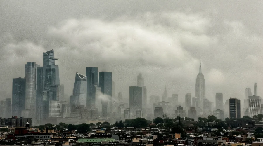
According to weather forecasts, there is increasing concern about slow-moving thunderstorms that could deliver torrential amounts of rain to certain areas on Tuesday. These storms may begin developing by late morning or early afternoon, depending on local atmospheric conditions. Once initiated, the storms are anticipated to persist throughout the entire day, potentially causing prolonged disruption to daily activities. A photograph captured on July 18, 2026, shows storm clouds moving through midtown Manhattan in New York City, providing a visual representation of the type of weather patterns that could affect the region. The image, taken by Gary Hershorn for ABC News, illustrates the atmospheric conditions that meteorologists are monitoring closely.
Additional Context and Related Information
While this weather event is the primary focus, other news stories are developing simultaneously. A U.S. service member was reported killed with another wounded, according to CENTCOM, with updates released on July 19 at 10:21 PM. Federal health officials are also investigating five clusters of cyclosporiasis cases, as announced by the FDA on July 20 at 4:09 PM. Additionally, live updates regarding Iran indicate that President Trump stated Iran “will pay” for the killing of U.S. troops, with this information published on July 20 at 4:29 PM. Residents in the affected regions are advised to monitor local weather forecasts closely and prepare for potential disruptions to their daily routines. Emergency preparedness measures, including securing outdoor items and identifying safe shelter locations, are recommended for those living within the high-risk zones.
ABC News has identified three life-saving tactics to use if caught in a car during a flash flood, which could prove critical for drivers navigating the Interstate 95 corridor during the expected storm.
The combination of heavy rainfall, potential for severe thunderstorms, and the possibility of tornadoes makes this a significant weather event for the region. Communities from Kentucky to New Jersey should remain vigilant as the forecast continues to develop through Tuesday.