Gulf Coast communities prepare as Hurricane Isaias reaches Category 3 strength
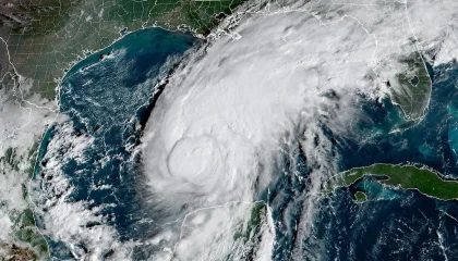
Cyberzenhub.com – Residents across portions of the U.S. Gulf Coast are making final preparations as Hurricane Isaias, a Category 3 storm, moves toward an expected Friday night landfall. The hurricane is forecast to come ashore between 8 p.m. and 10 p.m., bringing a dangerous combination of destructive winds, coastal flooding and rapidly changing conditions.
The greatest immediate concern stretches across a section of the northern Gulf Coast where a hurricane warning has been issued. The warning area begins just east of Biloxi, Mississippi, and continues through Mobile, Alabama, and Pensacola, Florida, before extending eastward to Panama City and Mexico Beach, Florida.
Evacuations focus on low-lying coastal areas
Evacuation orders are in place for many coastal and low-lying locations, with particular attention on communities along the Florida Panhandle. Residents in those areas are being urged to take evacuation instructions seriously and avoid waiting until weather conditions make travel unsafe.
Florida Gov. Ron DeSantis said Friday morning that some locations could experience winds approaching 120 mph. At that intensity, hurricane-force winds can make roads hazardous, damage structures and leave communities facing difficult conditions even before the storm’s center reaches land.
For households in the warning area, the hours before landfall are especially important. People should know whether they are covered by an evacuation order, identify a safe place to go if they must leave, and complete preparations before strong winds begin. Once tropical-storm-force winds arrive, travel can become increasingly dangerous and emergency response may be limited.
Storm surge threat extends along the Florida Panhandle
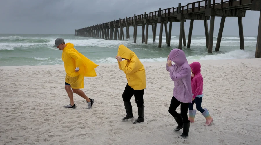
Coastal flooding is another major danger as Isaias approaches. Storm surge warnings are in effect along the shoreline, including the Florida Panhandle between the Santa Rosa/Okaloosa County Line and Grayton Beach.
Water levels in that section of coast could rise as much as 9 feet. Storm surge can push water inland quickly, placing homes, roads and businesses near the shore at risk. Its effects can vary from one community to the next depending on the coastline, local elevation and the timing of the storm.
Residents should not treat a storm surge warning as a concern limited to beachfront properties. Low-lying areas, coastal roads and neighborhoods near bays or other waterways can also become vulnerable when hurricane-driven water moves inland. Flooded roads may be impassable even when the full extent of the water is not immediately visible.
A narrow window for preparations
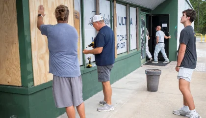
With landfall projected for Friday evening, Gulf Coast communities have a limited period to secure homes, gather essential supplies and finalize evacuation plans. Preparations should focus on immediate safety needs, including medications, identification documents, drinking water, food and reliable ways to receive emergency information.
People remaining outside evacuation zones should still be ready for power outages, blocked roads and hazardous debris. Wind conditions near 120 mph can damage trees, utility equipment and unsecured outdoor items. Objects left outside can become dangerous in severe winds, while damaged power lines and standing water can create additional risks after the storm passes.
Those who have been told to leave should follow local instructions promptly. Delaying departure can increase the chance of encountering traffic, deteriorating weather or road closures. A storm’s projected landfall point also should not be viewed as the only place at risk, since hurricane hazards can affect communities well away from the center.
Conditions may worsen before landfall
Hurricane Isaias has strengthened into a Category 3 system, a level that signals the potential for serious wind damage. The forecast timing places the most intense period of concern during Friday night, when darkness can further complicate travel and emergency decisions.
Communities from Mississippi through the Florida Panhandle are preparing for the storm’s impact, but residents should remain attentive to official local guidance as conditions develop. Changes in wind, water levels and rainfall can occur quickly in the final approach to landfall.
The central message for the affected coastline is straightforward: complete preparations early, respect evacuation orders and avoid unnecessary travel as the hurricane nears. With powerful winds and a potentially life-threatening surge expected along parts of the coast, safety decisions made before Friday evening could be critical.
Related Reading
Frequently Asked Questions
What is Hurricane Isaias updates?
Hurricane Isaias updates is the main topic of this guide. The article explains the context, practical details, and next steps readers should understand.
Why does Hurricane Isaias updates matter?
Hurricane Isaias updates matters because readers are looking for a useful answer, not just a short summary. Good content should match search intent and help them decide what to do next.