Waterspouts Turn Deadly on Long Island’s South Shore as Rare Tornado Outbreak Strikes Queens and Nassau County
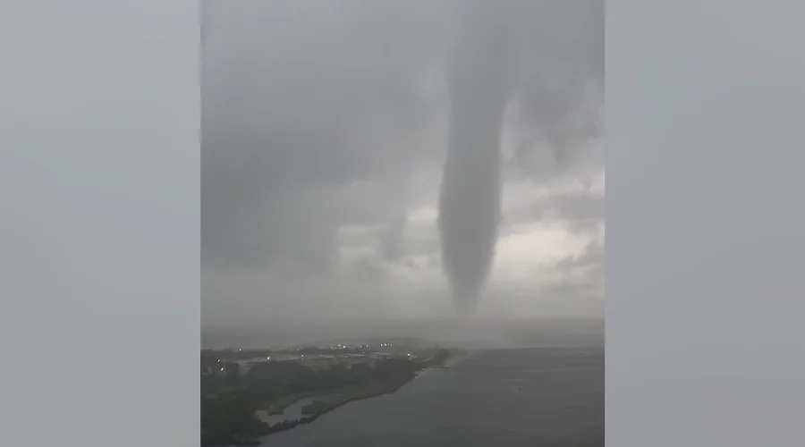
Cyberzenhub.com – For most residents of New York’s coastal communities, a tornado is something that happens in the Midwest or the Deep South. Yet on Thursday evening, August 20, 2026, that assumption was shattered along the sandy stretches of southern Queens and southern Nassau County, where at least two waterspouts — rotating columns of wind and debris that form over open water — tore through the shoreline between roughly 6:30 and 7 p.m. The National Weather Service confirmed the events, marking the first multi-waterspout outbreak in the area since a similar episode in November 2021. One of the two confirmed vortices made landfall as a full tornado, leaving a visible scar of destruction across Atlantic Beach and the eastern Rockaways.
A Beach Club at the Center of the Damage
The most concentrated destruction fell on Sun and Surf Beach Club in Atlantic Beach, a long, narrow barrier island in Nassau County that sits just south of the Rockaways. According to the chief fire marshal of the Inwood Fire Department, the tornado damaged or destroyed thirty one-story cabanas at the facility and injured one person. The injured individual, identified as a beach club employee, declined medical treatment at the scene. No other civilians or first responders were reported hurt.
Search-and-rescue crews were dispatched immediately to comb through the wreckage of the cabanas, ensuring no patrons or staff were trapped beneath collapsed structures. Nearby, Silver Point Beach Club also sustained property damage from the same rotating wind event, according to Nassau County Executive Bruce Blakeman, who declared a state of emergency for the county on Thursday.
“A state of emergency was declared Thursday in Nassau County,” Blakeman said, confirming the scale of the response required across the south shore.
Why Waterspouts Matter on the South Shore
Waterspouts form when warm, moist air over the Atlantic Ocean or Long Island Sound interacts with a passing storm system, producing a rotating column of wind that can reach tornado-level intensity. When such a vortex crosses from water onto land, it becomes a tornado in the conventional sense, though its structure and duration often differ from the long-track supercells familiar in the Plains states. The south shore of Long Island — a low-lying, sandy barrier island system barely a few meters above sea level — is particularly vulnerable because there is little topographic relief to disrupt the wind field, and structures built close to the waterline face the full force of the vortex.
The last comparable outbreak in this stretch of coastline occurred in November 2021, when a late-autumn storm system spawned multiple waterspouts that briefly touched down along the same barrier islands. The roughly five-year gap made Thursday’s event a reminder that the region’s exposure to coastal tornadoes, while statistically uncommon, is not negligible.
Flooding Compounds the Crisis
The same severe storm system that spawned the waterspouts also dumped heavy rainfall across the south shore, producing flash flooding that trapped motorists in their vehicles along low-lying roads. Nassau County Executive Blakeman confirmed that first responders spent the evening assisting drivers stranded by rising water, adding a second operational burden to the tornado response. The combination of rotating wind damage and inundation meant that emergency crews had to work on two fronts simultaneously: clearing structural debris and performing water rescues.
A Second Tornado in Dover, Delaware
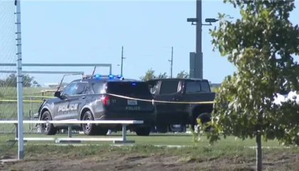
The storm system did not limit its effects to New York. On the same Thursday night, a separate tornado struck Dover, Delaware, producing what the Dover Police Department described as extensive damage across the city. Downed trees, widespread power outages, and localized flooding were reported throughout the municipality. Dover officials declared a state of emergency and urged residents to remain indoors while utility crews and municipal workers worked through the night to restore electricity and clear debris from roadways.
The broader pattern — severe storms delivering flash flooding, heavy rain, and strong winds across the Northeast and Mid-Atlantic on Thursday night — placed both events within a single synoptic-scale weather system, though the tornadoes themselves were distinct, localized phenomena.
Assessment Underway
The National Weather Service, working alongside emergency-management partners, is conducting a post-event damage survey to determine the tornado’s intensity rating and to map the full extent of its impact corridor. Until that assessment is complete, the precise Enhanced Fujita scale rating for the Atlantic Beach vortex remains undetermined. The agency emphasized that the review process typically involves field teams walking the damage path, interviewing witnesses, and cross-referencing radar and storm-chase data.
For the residents of Atlantic Beach, the Rockaways, and the wider south shore, the immediate concern is practical: how quickly the destroyed cabanas can be cleared, whether insurance coverage will restore the beach clubs before the remaining summer season, and what structural lessons the event offers for future coastal development in a region where barrier islands are already under pressure from sea-level rise and increasingly intense storm systems.
Related Reading
Frequently Asked Questions
What is Tornado waterspout rip through Long Island?
Tornado waterspout rip through Long Island is the main topic of this guide. The article explains the context, practical details, and next steps readers should understand.
Why does Tornado waterspout rip through Long Island matter?
Tornado waterspout rip through Long Island matters because readers are looking for a useful answer, not just a short summary. Good content should match search intent and help them decide what to do next.